- Mapbox
- Geolocation
- Clustering
- React
- Vimeo
I did the Annapurna Trek in November 2019, a 30 day trek in the Himalayas.
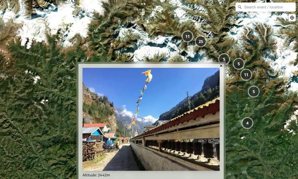
Interactive map of the Annapurna Circuit Trek in Nepal, also known as NATT (New Annapurna Trekking Trail). This trek crosses two different river valleys and encircles the Annapurna Massif. The path reaches its highest point at Thorung La pass (5416m), touching the edge of the Tibetan plateau. The mountain scenery, seen at close quarters includes the Annapurna Massif (Annapurna I-IV), Dhaulagiri, Machhapuchhre, Manaslu, Gangapurna, Tilicho Peak, Pisang Peak, and Paungda Danda. Numerous other peaks of 6000-8000m in elevation rise from the Annapurna range. I completed the trek solo in November 2019 (13.11. - 28.11.2019) for a distance of approximately 115 km.
The site uses Mapbox to show impressions and locations from the route, the longest trek I’ve done so far.
Features
- Mapbox: Custom map with the trek route and points of interest
- Geolocation: See where photos and stops were recorded along the trail
- Clustering: Markers cluster at lower zoom for a cleaner view
- Media: Vimeo embeds and imagery alongside map locations for context along the circuit
Architecture
- Map-first React app: Mapbox GL drives the primary canvas; trek geometry and POIs are layered as GeoJSON or equivalent sources.
- Photo / stop linkage: Geolocation ties gallery content to map markers so the narrative follows the route chronologically or spatially.
- Static-friendly deployment: Suitable for hosting as a static or Jamstack site with client-side map initialization.
Tech Stack
- Mapbox: Base map, route line, markers, and clustering.
- Geolocation: Anchors photos and stops to coordinates along the trail.
- Clustering: Reduces marker clutter at low zoom levels.
- React: UI shell around the map and media panels.
- Vimeo: Embedded video for route impressions and storytelling.